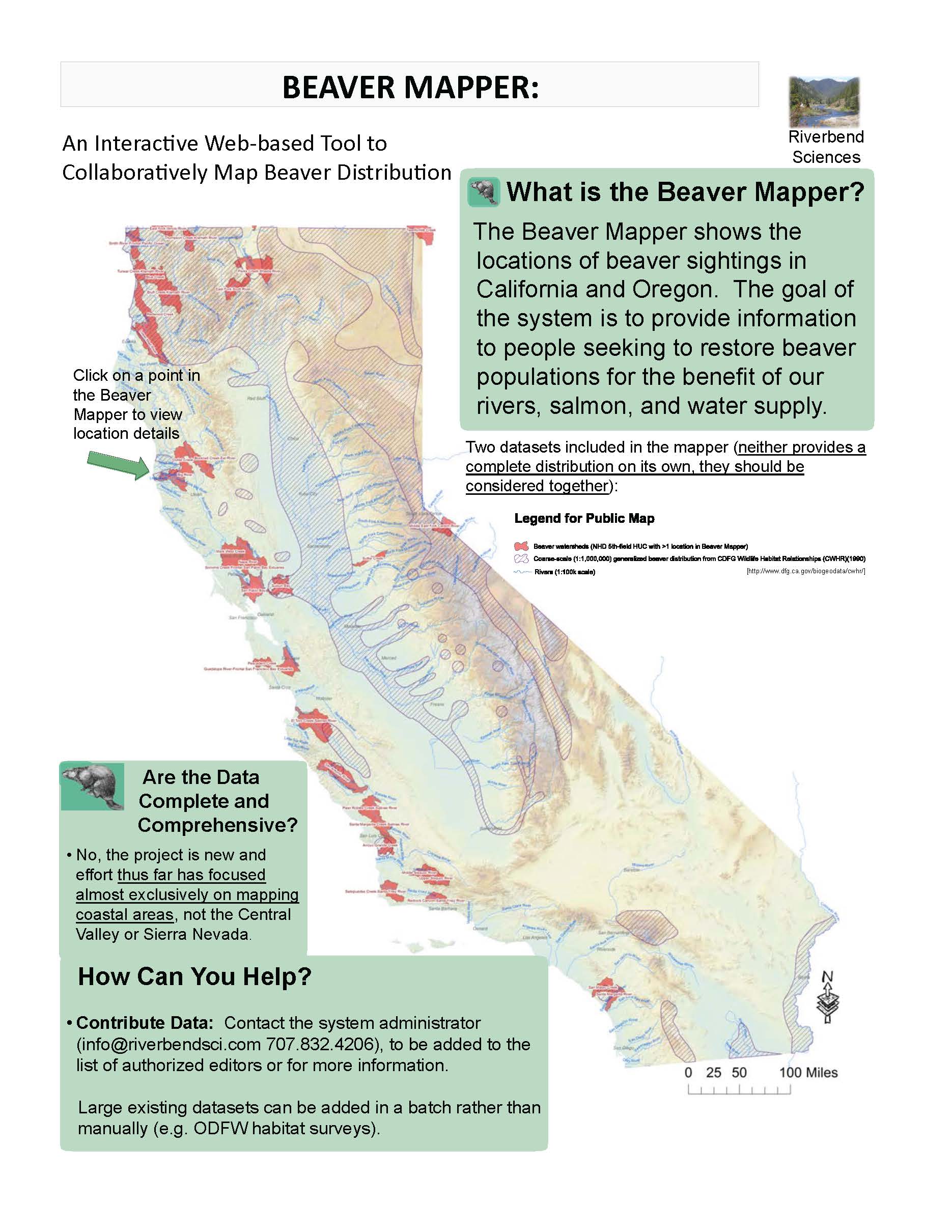
Join our Citizen Science campaign to map current distribution of beaver in California. As part of our Bring Back the Beaver campaign, The WATER Institute is collaborating with Eli Asarian of Riverbend Sciences to add locations to his Google Maps based beaver mapping project. Watershed-scale summaries of the data are publicly accessible, but specific locations are password protected.
You can also use iNaturalist to record observations and then email The Beaver Mapper administrator to upload your information.
Add beaver locations now!
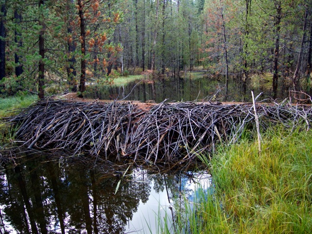
Top photo: Beaver dam at Childs Meadow by Brock Dolman/OAEC